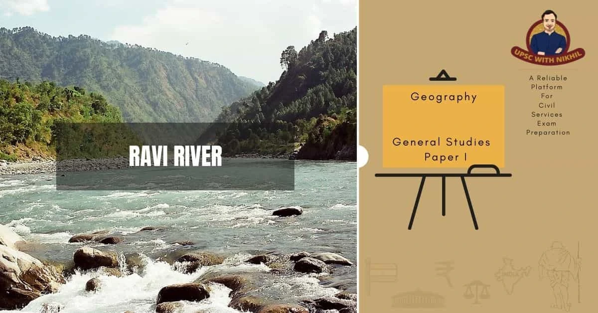
Ravi River
River Ravi, one of the Indus system's five rivers, is 720 kilometres long, with 320 kilometres in India, 158 kilometres in Himachal Pradesh, and 162 kilometres in Punjab, where it is exploited for fisheries resources.
MORE ABOUT RAVI RIVER
Ravi, also known as Irawati to ancient Indians, rises on the northern face of Rohtang Pass in Himachal Pradesh and flows as two channels, Budhil and Tantgari, at an elevation of 4,423 msl and 4,418 MSL, respectively, through the junction formed by the BaraBang- Dhauladhar range of the Himalayas.
It flows through Himachal Pradesh, primarily through the Chamba district, where it receives numerous tributaries. The river enters Punjab near Pathankot's Shahpur town, forms an international border while passing through Punjab's Gurdaspur and Amritsar districts, and finally exits Indian territory at Goina/ Kakarmani village, about 80 kilometres from Lahore. It is one of the few rivers with safe drinking water.
The Ravi rhitherone zone within the Himalayas has been extensively manoeuvred for power generation through the construction of many dams, including Chamera I, II, III, and Ranjitsagar/Thein.

The potomoan zone within plains has been exploited for irrigation by carving canals to the point where the river becomes an isolated entity after Modhupur, but it reclaims its riverine habitat thanks to the induction of several perennial and flashy torrents between Modhupur and Derababa-Nanak. These large-scale river changes must have had an impact on the basin's ecology and thus fishery, but how much and in what way is unknown.

TRIBUTARIES
The Ravi River rises in the Himalayas in the Multhan tehsil of Himachal Pradesh's Kangra district. It is a perennial river that flows in a north-westerly direction. The Budhil and Nai or Dhona, two of its major tributaries, meet 64 kilometres downstream from its source. The Budhil River rises in the Lahul range of hills and receives its water from the Hindu pilgrimage sites of Manimahesh Kailash Peak and Manimahesh Lake, both of which are located at an elevation of 4,080 metres.
Budhil is 72 kilometres long, with a 314-foot-per-mile bed slope. It runs through Bharmwar, Himachal Pradesh's ancient capital, now known as Bharmour. During the years 1858–1860, the Raja of Bharmour saw the Budhil valley as a good source of Deodar trees for the British Raj. However, a section of the temple's surrounding forest was designated as sacred and designated as a protected area. The Nai, Ravi's second tributary, rises at Kali Debi pass and flows for 48 kilometres from its source at Trilokinath to its confluence with the Ravi, with a bed slope of 366 feet per mile. During the English period, the valley's forest wealth was also exploited.
The Seul River, which flows from the north and joins the Ravi River just below Bharmour, the old capital of Chamba, is another major tributary. The river's valley was also exploited for its abundant timber trees. The valley, on the other hand, has large terraces that are very fertile and are known as "the garden of Chamba" Crops grown here provide grains to the capital region as well as Dalhousie and its environs. The Seva is another major tributary that joins the Ravi River near Basohli (J&K). This river was also exploited for its forest resources, which originated in the Jammu region and were controlled by the then Raja of Chamba. The Baira-Nalla, a major tributary of the Seul River, also forms part of the valley.
Tant Gari is a small tributary of the Pir Panjal Range that rises east of Bharmour from the Pir Panjal Range's subsidiary hill ranges. This stream forms a U-shaped valley with a riverbed littered with boulders and glacial morainic deposits.

MAIN RAVI RIVER
The main Ravi River flows past Chamba town and through the base of Dalhousie Hill. It is located at an altitude of 856 metres, where a long wooden bridge once crossed the Ravi River. It flows into the Punjab plain near Madhopur and Pathankot, then into the southwest near Dalhousie, cutting a gorge in the Dhauladhar Range before entering the Punjab plain near Madhopur and Pathankot. It then flows for 80 kilometres along the Indo–Pak border before entering Pakistan and joining the Chenab River. The river is about 725 kilometres long in total.
Another major tributary of the Ravi River is the Ujh River. Its source is in the Kailash Mountains, near the Bhaderwah Mountains in Jammu district, at an elevation of 4,300 metres. It joins Ravi at Nainkot, Pakistan, after flowing for 100 kilometres.
The Ravi is known as "The River of Lahore" because it flows past Lahore, Pakistan (26 kilometres below Amritsar, India), on its eastern bank. The river turns at Kamalia after passing through Lahore and then debouches into the Chenab River south of Ahmadpur Sial. The town of Shahdara Bagh, with the Tombs of Jahangir and Noor Jahan, is located on the river's western bank.
HYDROLOGY
The Indus Waters Treaty, signed by India and Pakistan, allocates the Ravi River's waters to India. The river is managed by the Supreme Court of India and the Ravi Beas Tribunal, which was established in 1986 for this purpose. The river is under the jurisdiction of the riparian states of Punjab and Himachal, as well as the non-riparian states of Haryana, Jammu & Kashmir, and Rajasthan. Upstream of the Madhopur headworks, the annual flow in India up to the final crossing point in Pakistan is 11.52 million acre-feet (MAF), of which 6.971 (MAF) is available. The majority of the water produced below the Madhopur headworks (4.549 MAF) flows into Pakistan.
The Ravi River system's hydropower potential has been estimated at 2294 MW, but only 1638 MW has been harnessed cumulatively, leaving 656 MW untapped. The 198 MW Baira Suil Hydroelectric Power Project, the Chamera-I of 540 MW capacity was commissioned in 1994, the Ranjitsagar Multipurpose Project of 600 MW capacity was completed in 1999, and the Chamera-II of 300 MW capacity upstream of Chamera-I commissioned in 2004 have all contributed to the hydropower potential developed since the 1980s.
INTERNATIONAL WATER-SHARING TREATY
The Indus River's upper reaches and tributaries are in India, while the lower reaches are in Pakistan. Following India's partition in August 1947, a dispute arose between India and Pakistan over the Indus River Basin's water sharing. With the help of the World Bank, the dispute was resolved, and a treaty on the sharing of the Indus waters between India and Pakistan was signed in 1960.
The Indus System of Rivers includes the Indus' three Western Rivers, the Jhelum, Chenab, and the Sutlej, Beas, and Ravi, as well as three Eastern Rivers, the Sutlej, Beas, and Ravi. The Indus Water Treaty was signed between India and Pakistan on April 1, 1960, under the supervision of the World Bank, to establish ownership of these waters.
Under Article 5.1 of the treaty, the rivers Ravi, Beas, Sutlej, Jhelum, and Chenab, which join the Indus River on its left bank (eastern side) in Pakistan, are to be shared. The eastern rivers, the Ravi, Beas, and Sutlej, are allotted to India for exclusive use before entering Pakistan, according to this treaty. However, a 10-year transition period was allowed during which India was obligated to supply water to Pakistan from these rivers until Pakistan was able to construct the canal system needed to use the waters of the Jhelum, Chenab, and Indus, which were allotted to it under the treaty. Similarly, Pakistan has exclusive use of the Western Rivers Jhelum, Chenab, and Indus, subject to certain conditions regarding the development of projects on these rivers in India. Pakistan was also compensated for the loss of water from the Eastern rivers on a one-time basis. After a 10-year moratorium, India has had full access to the waters of the three rivers allotted to it since March 31, 1970. The treaty resulted in the rivers being partitioned rather than sharing their waters.
The two countries also agreed to share data and cooperate on treaty-related issues under this agreement. The treaty called for the establishment of the Permanent Indus Commission, with each country appointing a commissioner. Despite many wars fought between the two countries, the Indus Waters Treaty is the only international treaty that has been implemented with due diligence and sincerity by both India and Pakistan over the last 60 years (the treaty was not revoked either by India or Pakistan during the 1965 or the 1971 war).
INTERSTATE WATER DISPUTE
India had developed projects on the Ravi and Beas River systems even before the partition of India in August 1947. India had taken steps to develop the three rivers that were eventually assigned to it under the treaty while the treaty was being debated.
According to an Indian government directive, planning for the development of the Ravi and Beas rivers began concurrently with treaty negotiations, involving four riparian states: Punjab, PEPSU (which was merged with Punjab and subsequently divided, and additionally the Haryana state was created), Himachal Pradesh, Rajasthan, and Jammu and Kashmir (J&K) within the Punjab state. With the merger of PEPSU and Punjab and the subsequent division of Punjab into two states, a dispute arose over the allocation of Ravi and Beas waters, for which the Interstate River Water Disputes Act established a tribunal.