Manas River
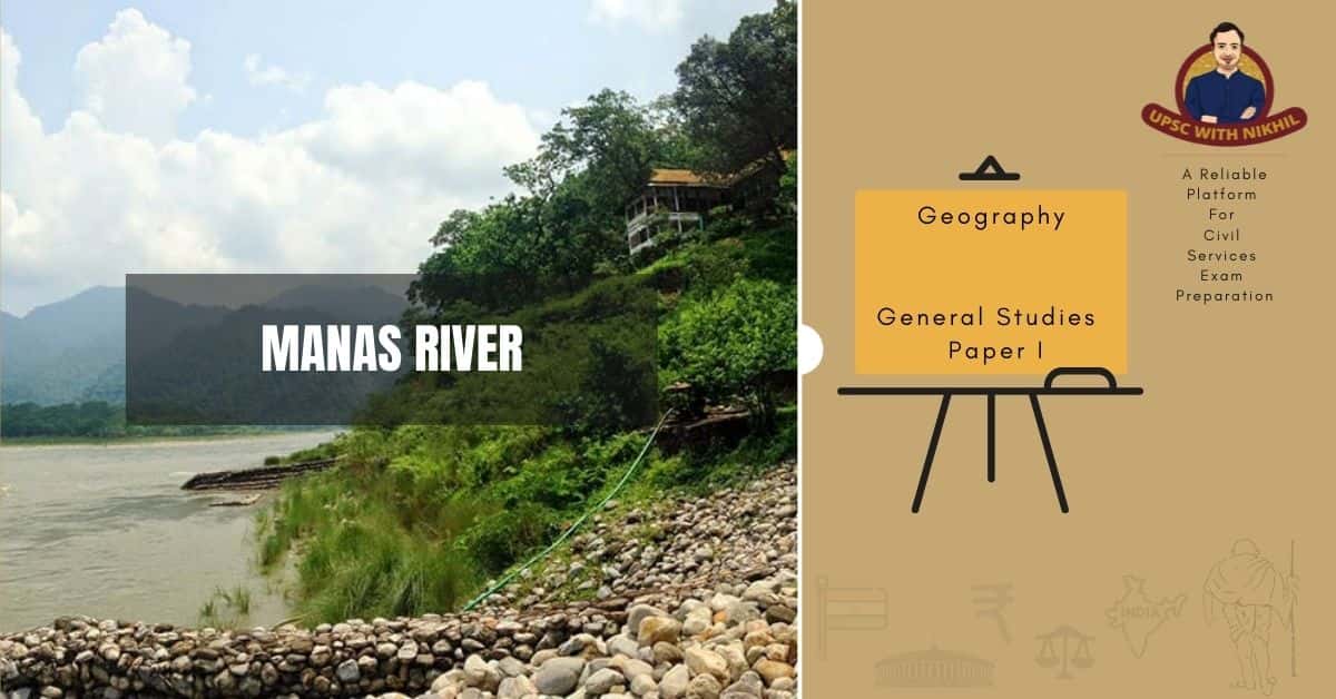
The Manas River, which flows between Bhutan and India in the Himalayan foothills, is transboundary.
It is the largest of Bhutan's four major river systems; the others are the Amo Chu or Torsa River, the Wong Chu or Raidak River, and the Puna Tshang Chu or Sankosh River. Before debouching into India in western Assam, it is met by three other major streams. The river runs for 400 kilometres, passing through Tibet, China for 24 kilometres, Bhutan for 272 kilometres, and Assam for 104 kilometres before joining the mighty Brahmaputra River at Jogighopa. The Aie River, a major tributary of the Manas, joins it in Assam at Bangpari.
The river valley is home to two major reserve forest areas: Bhutan's Royal Manas National Park and the contiguous Manas Wildlife Sanctuary, which includes a Project Tiger reserve, an elephant reserve, and a biosphere reserve and was designated as a UNESCO World Heritage Site in December 1985.

GEOGRAPHY
The Manas River flows through eastern Bhutan and northeast India, covering 41,350 square kilometres. It has three major branches: the Drangme Chhu, Mangde Chhu, and Bumthang Chhu, which cover the majority of eastern Bhutan, as well as the Tongsa and Bumthang valleys. A portion of the river's main stem rises in southern Tibet before entering India at Bumla Pass in Arunachal Pradesh's northwestern corner.
The river flows southwest through Bhutan, through V-shaped gorges between two Lower Himalayan ranges, and into Assam, India, in the south-central foothills of the Himalayas. The plains are marked by the formation of swamps and marshes as the valley opens up in the foothills. Snow covers the upper catchment, while the middle and lower catchments are densely forested.
The Manas or Gongri River, which originates in the West Kameng District of Arunachal Pradesh in India and flows in a southwesterly direction (the rivers in Bhutan generally flow from northwest to southwest), enters Bhutan near Tashigang and is the main stem of the river system. The Kulong Chu, which rises in Bhutan's northern Himalayan snow ranges, joins it at Tashigong. The riverbed width at Tashigong is approximately 550 metres, and the riverbed elevation is 606 metres. The river Kulong Chu is formed by two rivers: the Tongsa (Mangde) Chu, which rises near Kula Kangri Peak (1,666 metres) in northern Bhutan, and the Bumthang River, also known as Murchangphy Chu, which joins the Manas River.
The Lhobrak, also known as the Kuri Chhu, is the Manas' main central tributary. It is the only river that rises north of the Great Himalayas and joins the Manas in southern Bhutan; it is located further downstream of the Tongsa Chu. The riverbed level is 121 metres here. The Aie River enters India through the village of Agrong in the Goalpara district of Assam after flowing in a generally south-westerly direction for about 29 kilometres in Bhutan. It then follows a 75-kilometre meandering course before emptying into the Brahmaputra near Jogigopa. The Aie River, which rises at an altitude of about 4,915 metres near the village of Bangpari in the Black Mountains, is about 110 kilometres long. The Manas River is 376 kilometres long, with about 104 kilometres in India, measured along its longest tributary, the Kur.


The river valley in the foothills is surrounded by small meadows nestled among the densely forested foothills, which are home to numerous rivulets, streams, and natural drainage channels connected to the river system. There are many smooth sandy stretches dotted with trees in the river's lower reaches.
Terai and the Duars (A Sanskrit word meaning "passes" or "gates") are fertile foothills in Bhutan and India that stretch for 15–30 kilometres (9.3–18.6 mi). Each Duar (which ranges in elevation from 100 metres to near sea level as it approaches the Brahmaputra River) is named after a stream or is sandwiched between two streams. In Bhutan, a portion of the Duars was under British control. Tea estates and paddy fields have been established on the fertile lands.